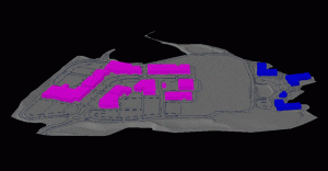
 Site development for many larger projects is now being accomplished with GPS machine control. This process allows heavy equipment to adjust automatically in the field to make cuts and fills in accordance with design plans thereby reducing operator error, saving costs associated with survey layout, and reducing construction time. In order to accomplish this a 3D machine control model must be created of the initial site design.
We create these models from paper plans or computer files within AutoCAD Civil 3D or Carlson Survey software. Typically these models contain 3D surfaces of the final grades as well as utilities and infrastructure so that maximum use of the model can be achieved depending on the equipment used by the contractor.


