DOCUMENT
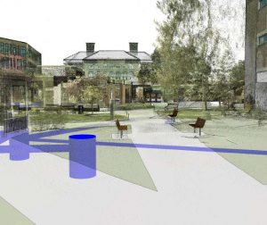
 The University of Massachusetts (UMass) Lowell campus decided to embark upon a project to update and revitalize the south campus quadrangle. In order to visualize their design, they asked LandTech to conduct a 3D laser scan of the proposed renewal area, locate subsurface utilities, and prepare a 3D model so they could get a better understanding of potential utility conflicts and “see” the impacts of their proposals.
DESIGN
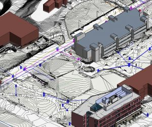
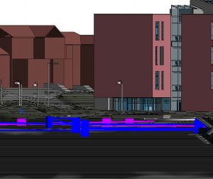
 Utilizing laser scanning and conventional survey technology, LandTech was able to document geospatially all above-grade improvements as well as below-grade utilities. LandTech was then able to utilize the laser scan point cloud in combination with located utility data to construct a 3D model of the area. Previously constructed models of buildings under construction in the area were then added to the model to enhance further the accuracy.
DEVELOP
 Overlaying the point cloud directly into the model, LandTech was able to create still graphics as well as a walk-through animation of exactly what the areas looked like at the time of documentation and what it would look like upon completion of demolition of structures to be removed, right down to the exact trees and shrubs currently in place. The added ability to know locations of utilities within the model assisted in further planning of future improvements.
“As a campus planner, two of the biggest questions we deal with are: “where is it?” and “what if?” The laser scanning LandTech has done helps tremendously with both. We can, with a high level of accuracy, say ”this is where the door, wall, path, or tree is.” And, we can say in a visually compelling way, this is what it would look like if we removed this building or added this row of trees.”
– Peter Brigham, Associate Director, Planning & FIS, UMass Lowell


