DOCUMENT

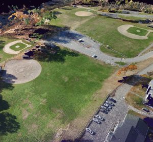
LandTech was hired by the Town of Ayer to survey, design, and permit the addition of an accessible perimeter path at Ayer’s Pirone Park. Utilizing the UAV (drone) and supplemented by conventional survey techniques, LandTech was able to complete the survey of the full 13+ acre site in less than three days. Using the UAV made the data collection quick and easy and as an added bonus, the video from the drone flight was able to be shown to the Town during the permitting process to aid in the visualization of the site and surroundings.
DESIGN

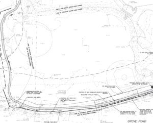
Using the UAV data and basic photogrammetry principals, LandTech converted the UAV data into a usable point cloud for insertion into Civil 3D and was used as the basis of design. The point cloud was also used to generate a highly accurate surface which was used during the design to ensure the path was graded in compliance with ADA, making it accessible for all.
DEVELOP

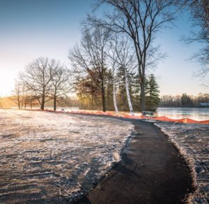
With the paving of the perimeter path completed in December 2018, the path has been enjoyed by hundreds of visitors of the park. The recently added park benches along the path and adjacent Grove Pond serve to enhance the already popular park. Having a path to access the various fields while also providing an outdoor recreation feature is a great addition to the park.


