CREATE
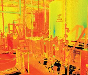
Civil engineering firm Hazen and Sawyer was working on headworks and effluent transfer pumping improvements at the Southern Region Water Reclamation Facility for the Palm Beach County Water Utilities Department. Utilizing 3D laser scanning for documentation of the existing building interior and exterior, LandTech Consultants completed all of the scanning in two days while the plant remained active.
INNOVATE
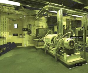
After the scanning, LandTech processed all of the scan data into one ReCap point cloud file. The point cloud was referenced to an existing coordinate system supplied by the client. Each point has a spatially accurate x, y, and z coordinate making it quick and easy to take dimensions between any two points. With recent enhancements of the ReCap dimensioning tools, outside pipe diameters are obtained with little effort.
INTEGRATE

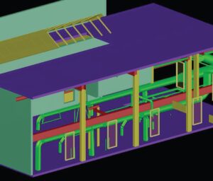
Utilizing the point cloud, LandTech produced a 3D Revit and Civil 3D model to aid in the design process. LandTech worked with Hazen and Sawyer to demonstrate the use of the point cloud file within Autodesk software, such as ReCap, Civil 3D, and Revit.
Download Palm Beach County Case Study PDF


